William Benitz Page last modified:
Missing brand

Cattle Brand

William Benitz
Maps of Ranchos

Missing brand

Fort Ross

The following are maps of the three ranchos in which William held ownership, as sole owner or partner, for three or more years between 1844 and 1867.  He rented Rancho Muniz (Fort Ross) from 1845 until he bought it in 1851.

Map Cal-1

Missing map.

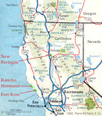
WB’s Ranchos
Northern California, USA

Rancho de Breisgau / Rancho Bresgau

(Shasta Co., ≈15,300 acres /  ≈6,200 hec.; WBz: 1844 - ca.1850)

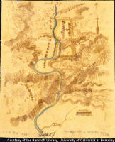
Map RB-1

Missing map.

Rancho de Breisgau
Diseņo by W. Benitz, 1844

(Courtesy of the Bancroft Library,
Berkeley, Calif., USA
)

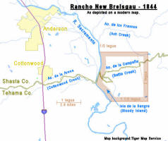
Map RB-2

Missing map.

Rancho Bresgau
(Depicted on a modern map)

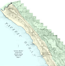
Rancho de Hermann / German Rancho

(Sonoma Co., patented 1872 at 17,580 acres / 7,110 hec.
WBz shared: 11,000+ acres / 4,450+ hec., 1846 - 1853)

Map RH-1

Missing map.

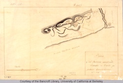
Rancho de Hermann
Diseņo by W. Benitz. 1845

(Courtesy of the Bancroft Library,
Berkeley, Calif., USA
)

Map RH-2

Missing map.

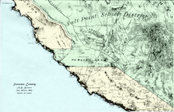
German Rancho
Sonoma Co. Map of 1877, Page 1

(Source: Sonoma Co. Recorder’s Office
Santa Rosa, Calif., 2003
)

Rancho de Muniz & Fort Ross

(R.Muniz: Sonoma Co., patented 1860 at 17,760 acres / 7,190 hec.
WBz leased: 1845 - 1851, owned: 1851 - 1867)

Map RM-1

Missing map.

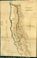
Rancho de Muniz
Diseņo presented by Manuel Torres, 1844

Fort Ross (not shown) is to the north-west (left) of Rancho de Muniz.
(Courtesy of the Bancroft Library, Berkeley, Calif., USA)

Map RM-2

Missing map.

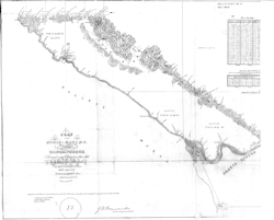
Plat of the “Muniz Rancho”
US Survey, 1859

(Source: Sonoma Co. Recorder’s Office
Santa Rosa, Calif., 2015
)

Map RM-3

Missing map.

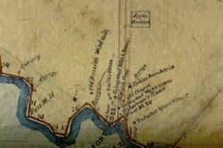
Fort Ross (excerpted)
Plat of the “Muniz Rancho”
US Survey, 1859

(Courtesy of Glenn Farris)

Map RM-4

Missing map.

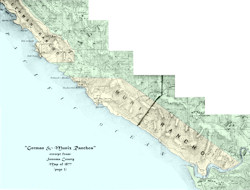
‘German Rancho’ & ‘Muniz or Fort’
Sonoma Co. Map of 1863

(Source: Sonoma Co. Recorder’s Office
Santa Rosa, Calif., 2003
)

Map RM-5

Missing map.

‘German Rancho’ & ‘Muniz Rancho’
Sonoma Co. Map of 1877, Page 3

(Source: Sonoma Co. Recorder’s Office
Santa Rosa, Calif., 2003
)

Map RM-6

Missing map.

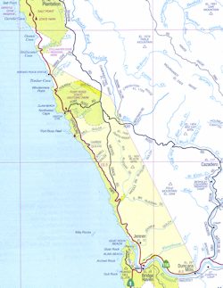
Rancho de Muniz
Approximate boundaries,
drawn on a modern AAA map.
(Created by P. Benitz)

Smaller Holdings

Map SH-1

Missing map.

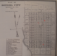
Town of Sonoma, 1877
William owned lots: 19, 34, & 199
(highlighted in red)
(Modified, from: Historical Atlas Map of Sonoma County,
by Thos. H. Thompson & Co., Oakland, Calif., 1877
)


© Peter Benitz (Benitz Family)